- Lewis Springs Area
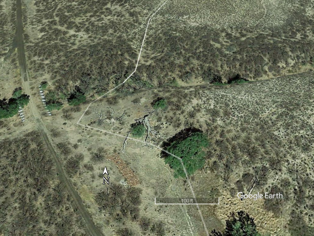
April 2013 satellite view of Lewis Springs area
The building ruins to the right of the north pointing compass might be those of a former railroad station. To the left of the compass is the former roadbed of the El Paso and Southwestern Railroad Railroad. There was a very popular resort area somewhere near here from approximately 1900-1913. At its peak the resort had a grove of cottonwoods that provided shade that people greatly enjoyed while picnicking. There was also a natatorium, bathhouse, dance pavilion, baseball field, and other amenities. Click here to go to page with information about the Lewis Springs resort.